Tour du Mont Blanc Trail Conditions Full Report
16/06/2024
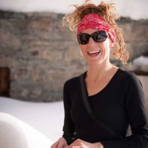
Vic Chelton one of our experienced guides has been out on the Tour du Mont Blanc this week to experience the current conditions. This is what she has to say...
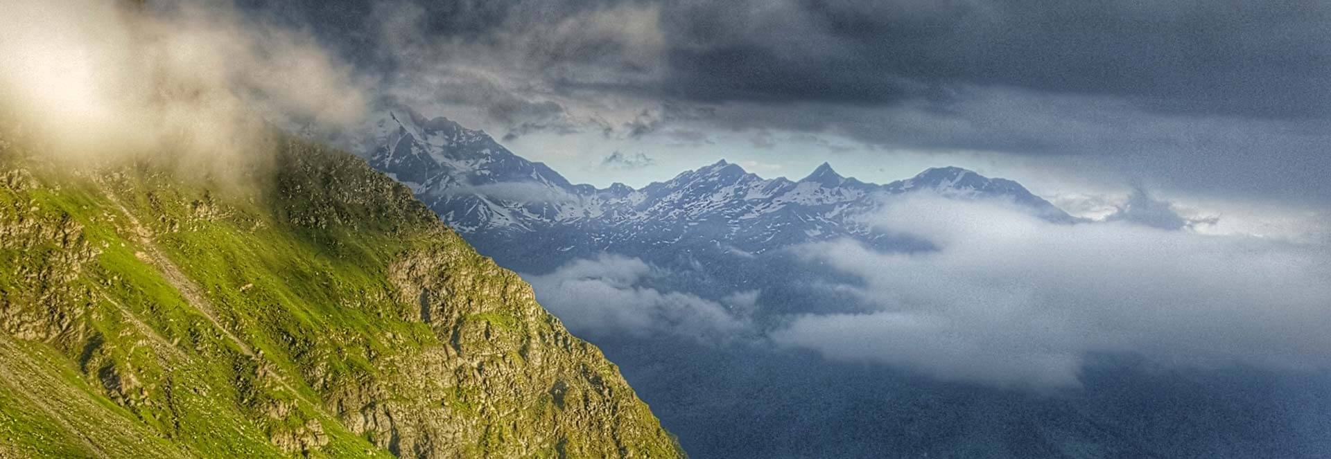
The Alpine trekking Season has officially started and conditions on the trails of the TMB are tough at the present moment. Another year of heavy snowfall from March - April followed by a wet and cold spring have made trekking in June tougher than previous years.
Having been out exploring the cols (mountain passes) and trail conditions, the 2024 season is much more challenging than a regular June. There is a lot of deep snow above 2000m , which means passing through any of the high cols involves winter style trekking.
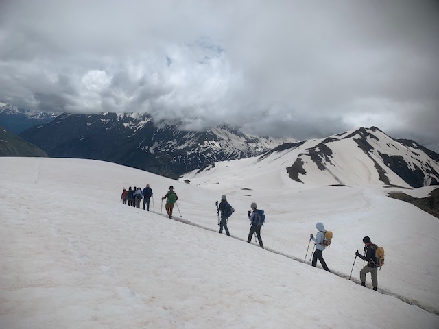
For the most part of June, there will be a lot of time for hiking on snow. For your own safety it's compulsory to be well equipped with good footwear, trail spikes/ lightweight crampons and trekking poles.
Most of the trails above 2000m involve spending most of time hiking on snow. This season the snow still remains deep and consistent.
However there is a remarkable amount of people out travelling the TMB, the busiest June I have seen in 16 yrs guiding on this route. Therefore there are good tracks to follow through any of the snow fields/ passages making route finding and snow conditions easier to follow. However there are some sections that require a steady head and good equipment, the tracks are easy to follow but a slip could be fatal in some areas.
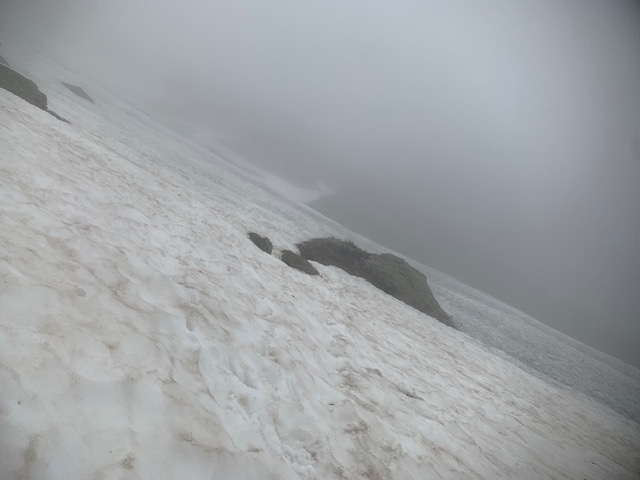
Below 2000m due to a wet spring the trail conditions are very muddy which can make hiking equally more challenging. As the temperatures become warmer, the snow conditions will become more problematic, as holes will appear mostly around gully beds and stream crossings.
The consistent snow above 2000m presently means the actual main trail is buried, but easy to follow as many people have created a track to follow in the snow. Equally as the snow start to melt, route finding will need more focus and additionally create more muddy paths until the summer weather dries out the terrain.
In this report I give an update of notable points for some of the main sections and high cols also logistics to provide advice to aid your journey. Equally as the TMB is very busy, it's also a great opportunity to chat with fellow trekkers and also ask each local refuge/hotel for updated information as the weather and conditions continue to change.
Mont Blanc Treks will also keep a blog updated for important information .
Chamonix to Les Houches: The Planpraz / Brevent lift only opened on Saturday 15th of June. So there haven't been many people trekking in this area.
There is still a lot of snow above 2000m and even on the starting path heading up to col du Brevent there are some very big snow fields. Which are difficult to pass.
It's highly recommended to avoid taking this high level route as the section from Planpraz to Brevent has some exposed technical terrain which currently has a lot of snow. It will need some time for snow to melt to make it safe.
Information will be updated.
It is safer and advisable to follow one of the lower level routes.
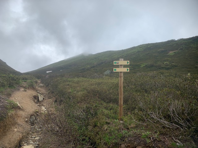
For example; the trail starts from Chamonix up to the Brevent lift parking area then continues leftwards following signposts eventually arriving onto the main trail of Petit Balcon Sud .
From here follow the signs and the trail up to the Parc Merlet .
Then descend down to Les Houches
It is a wonderful way to ease your body into the first day of trekking .
Also gain some height and some great views of the Majestic Mont Blanc if the weather allows.
Les Houches to Les Contamines: After leaving the Village of Les Houches it's recommended to take the cable car of Bellevue as the hike up through the ski area is not so inspiring.
The lift opens at 07.30 and the price is 18 euros for a one way ticket / Aller simple.
The trail starting from the top of the Bellevue Lift up to the Col Du Tricot is snow free.
However the trail is very muddy, due to a wet and cold spring.
The passerelle/ suspension bridge is In place.
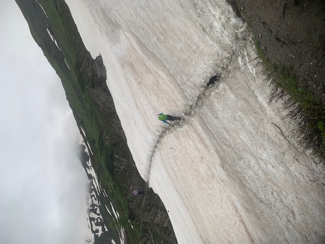
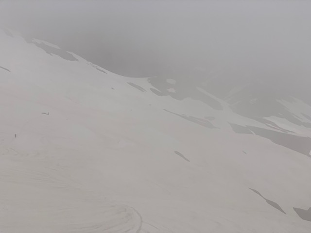
It is important to note that a new path was created 2 yrs ago .
Around the altitude of 18-1900m, see photo below.
It heads rightwards and zig zags up to Col du Tricot.
The old direct path has a lot of snow debris and is suffering from erosion. Therefore it's important to follow the signs and take the rightward trail.
The descent from Col du Tricot has no snow but the path is currently wet and muddy, so a slow descent.
The refuge of Chalet du Miage is open, so worthy of a break for a taste of it's famous myrtille tart or to buy the best omelette you will ever eat, if time allows.
It's another 2 hours minimum on trails without snow but maybe wet and muddy to arrive at the beautiful village of Les Contamines..
If you have bag transfer arranged you do not need to carry your hiking spikes/ crampons for this day as it will not involve crossing snow.
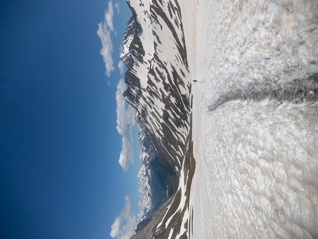
Les Contamines to Chapieux & Refuge Mottets: This one of the toughest days of the tour. Be well prepared to spend at least 5-6 hrs Trekking on snow.
The path is snow free up to around 2000m up to the notable rockpile of the Plan des Dames. 50m beyond here the snow line starts
There is a small snow patch to cross just after arriving at the obvious power line tower 30 mins uphill after passing the Refuge la Balme
It's easily crossable about 50m wide ,but be wary of holes in the snow as it has a big river below as you traverse, so attention is needed.
The refuge La Balme is opening soon for a last water refill to get enough for the rest of the day.
Equally use the Toilets and water fountain just before arriving at the refuge.
When you arrive at the rockpile of the Plan de dames 2000m, expect to be on Snow for 5 hrs.
Currently there is a large quantity of snow and many people have passed through so there is a very obvious trail to follow on the snow.
The snow is very forgiving and depending on the weather and conditions it can be possible to walk on without using spikes/ crampons up to the col du Bohomme as the track is well packed in. Equally it may be better to use your spikes depending on if you feel better with extra traction.
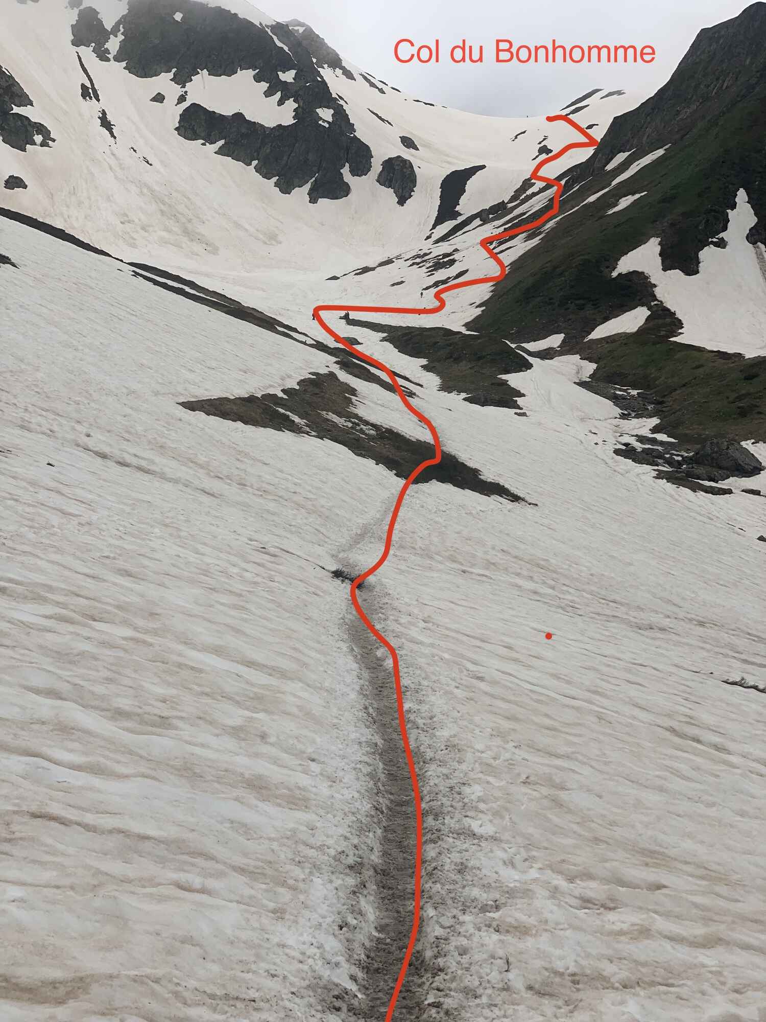
Photos are included to show you the route up to the Col du Bonhomme 2329m.
It is winter conditions at the moment so make sure you have lots of warm clothing.
The section between Col du Bonhomme and the highest point of Col de la Croix du Bonhomme is where much care and focus is needed.
It will take about 45mins to 1hr of traversing on continuous snow. The first 20 mins after leaving the Col du Bonhomme there are some very exposed slopes to cross with a good track to follow, but spikes/crampons are essential from this point onwards.
Currently the volume of snow makes it easier to follow the trail and easier.
However, be warned that as the snow melts over the next few weeks, this section of trail will become more problematic as holes will emerge and route finding will be less obvious. Extra focus is needed to follow the painted markers and signs.
From the highest point of Col de la Croix du Bonhomme 2483m.
You will see the junction to Col des Fours......Do not attempt to pass this direction. Its too dangerous with snow cover. It will need to be completely snow free so maybe in 3-4 weeks it will be possible
Head down to Les Chapieux passing the refuge of Bonhomme which is open for refreshments and toilets.
Expect 1.5hrs / 2hrs descent mostly on snow until 2000m , then can remove your spikes
Then expect some muddy trails to finish your day.
If you are staying at the Refuge Mottets walk up the road to Ville des Glaciers & on to the refuge, allow 1h 30mins. See info in paragraph below.
There is very limited or zero telephone signal for most of this day an not any signal until at least you arrive into italy. Wifi can be paid for at the small shop in Les Chapieux. But be prepared to be without telephone signal for 24hrs at least.
It's important to ask the locals on current conditions to head up the valley to Refuge Mottets.
Currently it's only possible to hike up the road to the Ville des glacier . For The Moment it is unsafe to use the alternative trail on the right side of the valley. It has avalanche debris and can be prone to rockfall and landslide until the snow fully melts.
A preferred option is to use the navette mini bus from Les Chapieux to avoid the long walk on a road to start your trekking day from ville des Glaciers.
It costs 4 euros and runs from 15th June to 15th september.
Check the timetable in the hamlet next to the toilet block, normally the first bus departs around 8 am.
From Ville des Glaciers the track is easy until the junction from Refuge Mottets.
Here the ascent begins up to the Col de la Seigne 2516m, the border crossing into Italy.
You will very quickly have many snow patches to cross and will eventually be on snow for 4hrs of the day. So Spikes/ crampons are essential.
From the high point of Col de la Seigne its winter conditions and the current descent path is not the regular summer route as Its full snow cover.
After around 10-15 mins descending from the col .
Pay attention to look for a path junction, the normal summer trail heads right passing the environmental museum.
However for the moment it is better to stay direct / leftwards and descend on the snow slopes to arrive at the bridge at around 2800m.
As the snow melts the regular summer trail to the Environment museum will be better but only until the snow has melted.
From the bridge there are small regular snow patches to cross, but can be done without spikes, as easily crossable.
When you get to the junction up to the Elisabetta Refuge it worth a 10 min hike to enjoy your first Italian treat.
Pay attention after 10 mins descending down from the refuge as there is a current snow passage which is best to followed on the right or direct down. Its covering the main 4x4 trail and is not a good way to pass.
When you arrive at the Valley 4x4 track it is simple hiking.
It is possible to take the alternative high route to Maison Vieille but more snow will be encountered.
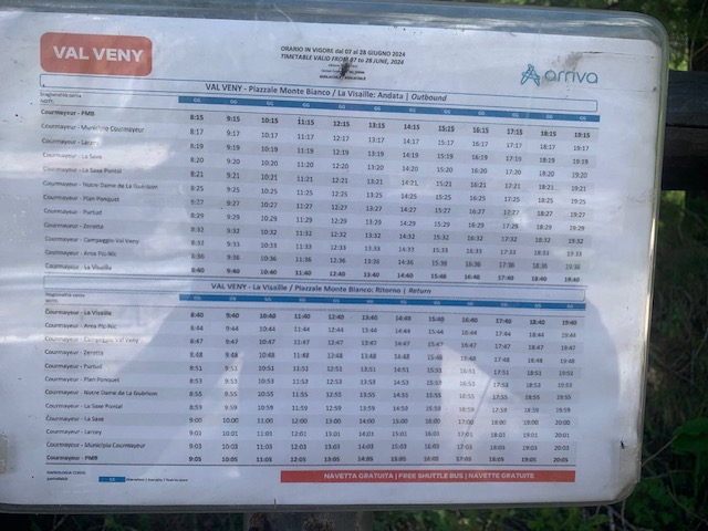
It is better to head down the valley to arrive at La Visaille and take the bus to Courmayer.
There is currently a bus every hour at 40 minutes past the hour.
Timetables changes on 28th june
Then the bus runs every 30 minutes
https://arriva.it/app/uploads/sites/3/2023/06/000931-CourmayeurValVeny-1.pdf
Its free of charge.
Courmayeur to Refuge Bonatti & the Val Ferret: This day is mostly snow free as it stays around an altitude of 2000m, however; some small snow patches may need to be crossed.
Particularly crossing any river beds/ gullies.
Do not attempt to take the high level route over the Mont Saxe ridge.
It's not safe due to the snow conditions for at least another 4 weeks.
Val Ferret to La Fouly: The Grand Col Ferret 2537m is one of the days that needs great attention. There is a lot of snow the higher you go with winter conditions at the col. Be prepared for walking on snow for most of the day.
A few small sections are exposed so need to passed with full equipment, fully focused and a steady head.
There is a very obvious track crossing any snow encountered which provides a track to follow, but in some places the track is narrow so extra care is needed, moving slowly and surely is important on this day.
From the head of the valley (Arnouva) at 1784m the climb to col begins. You have 2 options, if you take the left route to the refuge Elena is easy much easier and safer via a wide 4x4 track.
If you choose to take the right hand trail it's more complicated. The path is full of mud to start and there currently is 3-4 short but very exposed gully sections on snow to be crossed.
As the snow melts the main problem will be the huge gaps that appear between the earth and the snow patches. They are short crossings on snow but dangerous to pass as to slip here could be serious.
Taking the 4x4 track would maybe take a bit longer but will be stress free.
Also on the higher route 100m below Elena refuge the bridge is not in place. The gully is full of snow, currently easy to pass. This will become a problem when the snow melts until the bridge is back installed.
Elena refuge has delayed opening beacuse of the snow, they open on 1st July.
The trail from Elena refuge to the Grand col Ferret is a mix of snow patches, some are exposed. On the sections without snow there is a lot of mud. Also due to snow patches, the main path l is not being fully followed.
Have your Microspikes at the top of your bag and allow extra time for putting them on and off. At 2485m it is full winter conditions & the track from this point to reach the Col will be on snow.
There is a 100m section before arriving at the col that needs extra attention, as you will need to make a traverse on exposed snow slopes.
There is a track to be followed as many people are passing. You must stay focused with each step on this section to arrive at the Grand Col Ferret safely.
The descent from the Col is winter snow conditions all the way to you arrive to the Swiss refuge of La Peule.
There is a short section on the trail 20-30 mins before you arrive at the refuge around 2200m with a 100m section that is more exposed. But the descent despite the snow is easily passed.
The descent after the La Peule refuge is relaxed. It is better to follow the 4x4 trail and onwards to Ferret or La Fouly
La Fouly to Champex Lac: From La Fouly the trek stays at a much lower altitude so passing snow is not an issue.
Champex Lac to Trient: Do not go via the Fenetre d'Arpette, the col is very steep at the top on both sides and it is extreamly dangerous at the moment. This route will not be passable for at least another 4 weeks.
The Bovine route is your only option on this day. Due to raising temperatures and snow melt crossing rivers needs care & atention. The path from Champex Lac towards the Bovine Refuge has 2 river crossings that need to be passed safely.
Also the section of path regularly gets flooded around the altitude of. 15-1600m metres at altitude. Be prepared to cross the 100m section in barefoot, maybe pack any extra pair of dry socks on this day to keep your feet in good condition.
After Bovine follow the well marked trail to the Col Forclaz & on to the village of Trient. A perfect opportunity to share some chat with your fellow trekkers in its bar/ social space.
Trient to Argentiere: From the village of Trient the easiest passage is to head directly up to the Col du Balme. Follow signs in SW direction to the end of the road and trail easy to find. There is a wonderful refuge with great cakes that sits on the border of France and SwitzerLand. Descent from here is long but the paths are easy to walk and follow.
Argentiere to Chamonix: It's too early to take the famous ladder route and to visit Lac Blanc, there is just too much snow. Take the route from the village centre, direction Chalet Cheserys & Flégère.
After passing Flegere ski station, continue for 2 more hours to the Planpraz cable car.
Finally it's time to take the lift down to complete your journey.
You may encounter some snow passages on this final section.
Last lift is at 17h00
Bon Courage, stay safe & you will experience a trip of a lifetime 💪
Also see our Facebook & Instagram page for video footage.
About the Author