Tour of the Monte Rosa trail conditions
30/06/2024
As we have our first self-guided clients arriving next week to start the Tour of the Monte Rosa, Vic Chelton one of our experienced guides has been out on the route to have a good look before the arrival of our first guests.
We expected conditions to be the same as the Tour du Mont Blanc, however; there isn’t the volume of folk on this route so trail finding with snow cover on the high ground will inevitably be problematic.
Here is Vic’s report…
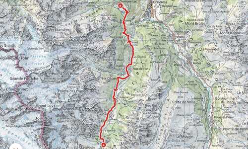
This week I made a 5 day circuit of some of the main sections of Tour of the Monte Rosa to review the current state of the trail. I know the route well and have guided many times before, at this point in time the trail is not in summer trekking mode.
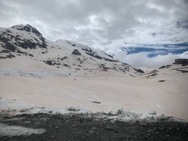
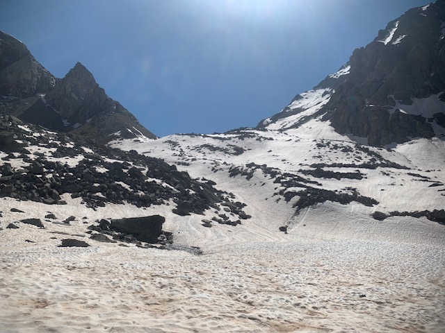
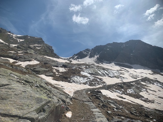
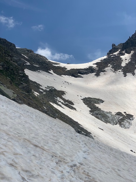
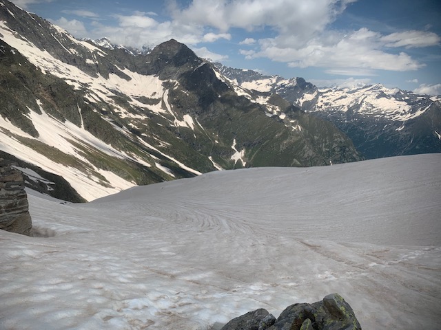
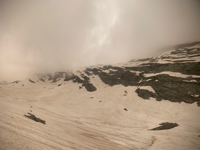
There is still large quantities of snow above 2200m.
Also some of the lower sections have been affected by flooding, which has caused landslides. There are some sections of path closed mostly on the Swiss side.
The Mattertal Valley was closed off completely for a few days after huge floods.
It's now open again, but each sector of the commune is busy cleaning up the destruction in the valley.
It's Important to take each day at a time and to get local information from the Guides & Tourist office every evening from the following day ahead.
The buses and cable cars are running, but some of the refreshment stops along the route are not open.
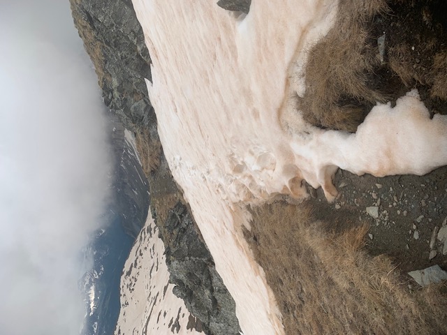
It's highly important to understand that some of the main high passes are very complex to pass as the trail is buried under snow, above the snow-line route finding is more complicated, signs & painted markers are not visible.
Iif you are doing this route you will need, boots, crampons & an ice axe to make crossing the snow as safe as possible. In addition to basic mountaineering knowledge of how to use this equipement is essential.
I didn’t see anyone doing the TMR, therefore there were no tracks to follow. This will change as more people start the route.
Some snow sections can be intimidating to cross as a slip in places would be serious.
Microspikes & poles would not be adequet at this moment in time.
Ice axe and crampons in my opinion are vital.
Some days you can expect to spend several hours on snow, north facing descents are problematic. In addition to complex snow crossings, route finding issues, river and stream crossings are also another obstacle, due to snow melt.
In addition gaiters, good footwear and quality socks will help, however; expect to have wet feet most days.
Here are my notes for each day…
Zermatt to Refuge Theodule: On arrival to Zermatt check to see if the cabel car from Zermatt to Trockensteg is open. Lats week it was closed due to landslides beyond Furi.
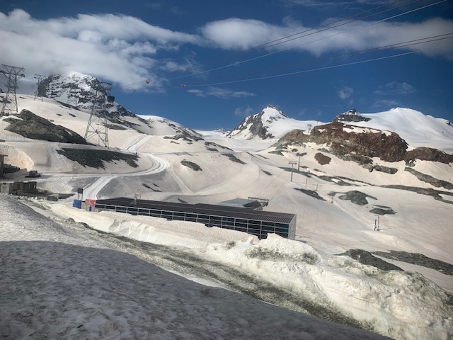
I used the cable car from Trockener Steg. It's helpful to also get a lift/piste map to aid Navigation. The first cable starts at 815 am, arrive early to avoid the ques. Above Trockenersteg the glacier is still a ski piste, there are still many people out spring skiing. The hike up the glacier follows a ski piste. The Snow is wet and heavy, the later in the day, the wetter it becomes. This section is actually easier than normal due to the quantity of snow covering the glacier. It's not so inspiring, but safe as it's well marked.
Zermatt is busy and pay attention to the constant whizzing of electric cars and people on bikes.
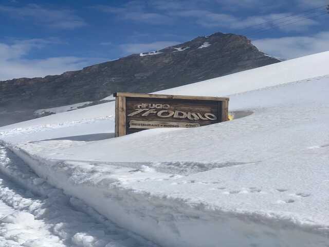
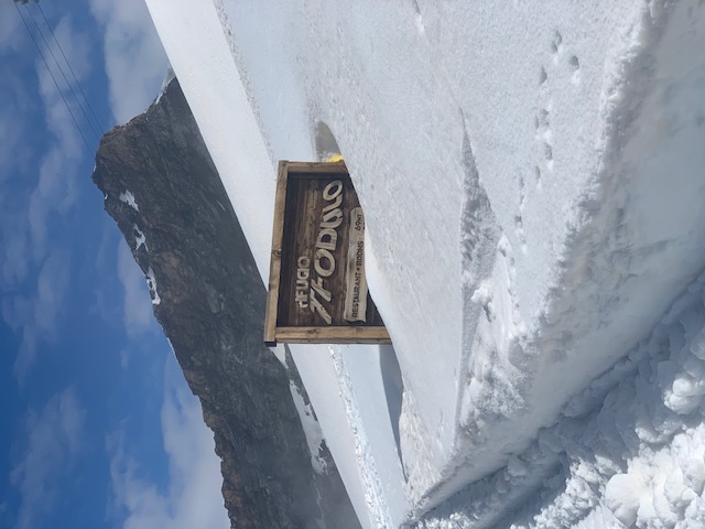
Use the route card information and map to locate the refuge which is surrounded by a lot of snow.
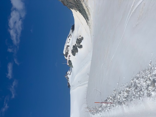
Refuge Theodule to Resy: This day is much more complex to route find as 80% of the day is on snow and the markers are buried. The passages beyond the Col Nord des Cimes Blanches are serious to pass. Allow at least an extra 2 hrs onto the day for navigating, deep snow and equipping yourself.
Also have plenty of water.
Use route description but expect to see very few markers for a large part of the day.
The section from the refuge Theodule to Col Nord des Cimes Blanches is pretty gruelling. Currently there are many piste machines clearing snow & the dirt tracks are really muddy. The snow is heavy and wet.
Points to Look out for......
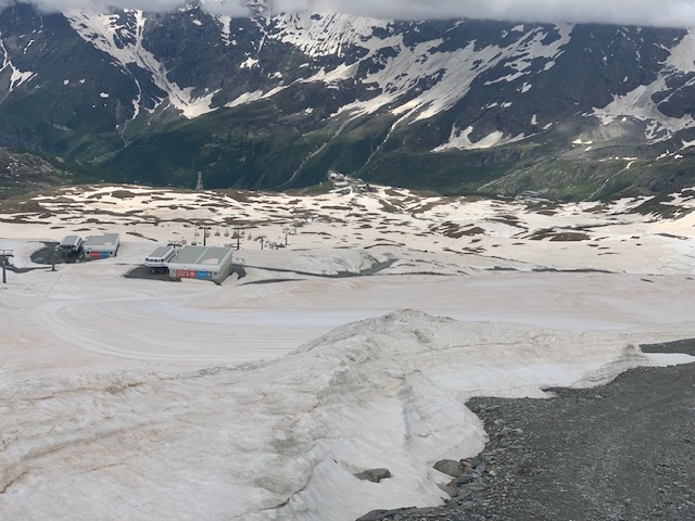
From the chapel of Cappella Bontadini at 3048m descend the dirt piste. You will then see the 2 cable cars just below. From here follow the dirt track to the left which eventually becomes a snow piste that traverses an old lift station. This will lead you the lift station of Plan Maison 2555m.
From here is more gruelling ski piste walking heading up to the Col Nord des Cimes Blanches 2981m. Pay attention as you reach the col as the piste starts to descend.
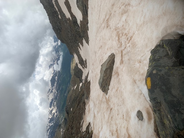
Look for the small water reservoir and snow cannons. Look left to locate the cairn at the start of descent path to the Italian side. It has some coloured flags.
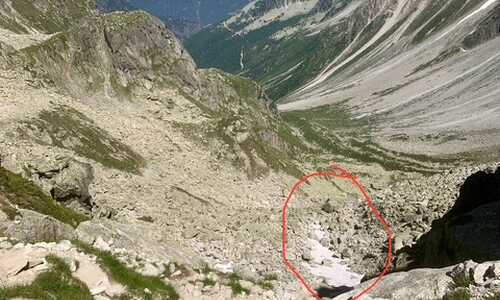
From this point the descent to the Grand Lac is very serious. Be sure to have your axe and Crampons on and ready. Do not try and follow where the path should go, be creative and look for the safest way to descend.
Excellent mountain & navigation skills in snow are essential for this day. Do not pass in poor weather or if you dont have the appropriate experience.
Resy to Stafal via the Passo de Rothorn 2689m: This day Is currently more difficult as the Passo del Rothorn still has lots of snow and route finding is more complex.
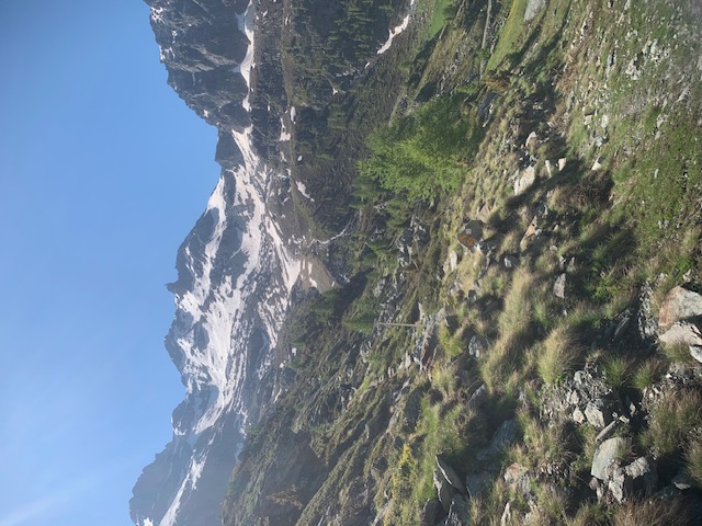
Use route description and follow signs for the first part of day. Always looking for the TMR Signs and markers. It's Snow free for the first part of the day.
After Passing The Monte Cavello Cable car Building, locating the left path that heads towards the passo, You will see snow ahead. There are many streams and rivers to cross which can be difficult due to the volume of flow. Eventually the path will become buried in snow. The snow is deep and hard to walk on when soft.
Weave your way rightwards then left and locate the cairn and sign of the Passo Rothorn.
You need to have crampons to descend from here. DO NOT attempt to go directly down from col as snow is steep here.
From Passo go right for about 100m and you will find easier angled snow slopes to descend. Watch out for big holes in the snow, especially around river beds.
It's steep and needs concentration. Soon the path appears but there are some snow patches on the trail that still need to be traversed across, take great care passing these.
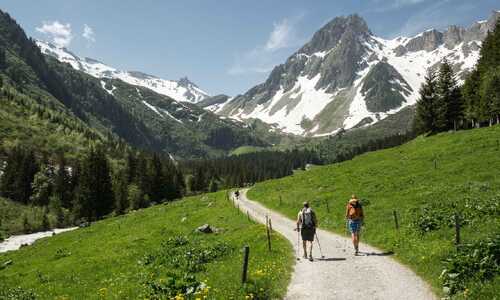
Eventually when snow stops around 2300m. Then it's easier to follow using route description and path markers
Ecellent mountain & navigation skills in snow are essential for this day. DO NOT pass in poor weather or if you dont have the appropriate experience.
Stafal to Alagna Col d’Olen 2881m: This day needs full itinerary change as there is too much snow from Colle Olen and Passo Foric to dangerous to cross.
The path up to first lift of Gabiet is fine. Section from top of first lift to Col d’Olen is on a ski piste with heavy wet snow. The snow beyond old burnt out refuge is steep, it is
safer to follow ski piste from the Col d’ Olen to Pianalunga and hike down 4x4 trail to Alanga village.
The best pption would be to hike to the top of the first lift, then take Gabiet lift x 2 cabins to Pianlunga and hike down from there.
This would avoid a day on snow.
Full cable car crossing costs 30 euros.
Alagna to Macugnaga via colle del Turlo 2738m: The navette bus running & is work taking to save time as it’s a big hike up to col. The snow starts to cover the path around 2400m, the snow is soft on the south side.The trail is visible, snow patches to cross on ascent.
From Col Turlo 2738m the north facing descent is in full winter conditions. There are tracks in the snow but only after 20m/30 mins of descent. Route finding difficult and lots of exposed steep ground to pass through. The military path occasionally visible but you will be descending snow to around 2200m.
Excellent mountain & navigation skills in snow are essential for this day. Do not pass in poor weather or if you dont have the appropriate experience.
Macugnaga to Sass Fee via the Passo Monte Moro 2984m: Lift is operating and costs 15 euros to the top. Its worth taking the lift to save time.
It is full winter conditions & there are still people skiing in this area. Very careful route finding will be needed. It is not possible to descend via the normal trail from the Monte Moro to Mattmark.
Need to take an alternative route into the Valley floor on the left on steep snow slopes. nw direction, there is snow down to 2400m and snow bridges & rivers need
The Mattmark bus is running.
Excellent mountain & navigation skills in snow are essential for this day. Do not pass in poor weather or if you dont have the appropriate experience.
Sass Fee to Grachen: Path currently closed from Saas fee to Grachen, it is important to stay updated with local info available from the Tourist Office. They are curremntly carrying out repairs to the route and reinstalling hand rails and safety equipment.
It will be neccessary to take the trails in the valley bottom.
Grachen to Zermatt: This whole section of path and valley/ train services had just experienced serious flooding and landslides, which has caused a lot of damage so was closed off.
However a lot of work is being done to restore it, it needs constant attention for updates from each local commune and website info. The Zermatt web page and europaweg links are generally regularly updated to get Information:
https://www.zermatt.ch/en/Media/Liveticker-Zermatt-Matterhorn/Aktuelle-Situation-Zermatt-Matterhorn
Additional information
Cable Car from Zermatt to Troknersteg one way costs 47 chf
Navette bus Alagna to start of trail to Pastore costs 3,50 euros
Safety is the most important thing, you must be able to reverse any crossings if the terrain becomes too challenging.
Due to the direction of the TMR many descents are north facing and descending and traversing on snow is more difficult.
Even with hot weather it will take at least a month for most of the snow to fully clear.
Some sections do not have telephone signals, so emergency / rescue needs to be considered
Important to have an emergency plan in place.
Weather is really Important as passing some sections without visibility is dangerous.
Making use of buses & cable cars will be useful as the days are longer due to conditions.
This trek must not be underestimated in the current conditions and it requires excellent mountain & navigation skills in snow are essential for all days. Do not pass in poor weather or if you dont have the appropriate experience.
There will be some video footage posted on our Facebook & Instagram pages.
No further updates will be posted, please check local guides & tourist offices for up to date information.