Tour of the Monte Rosa Guided Trek
Loading map...
Tour of the Monte Rosa Guided Trek
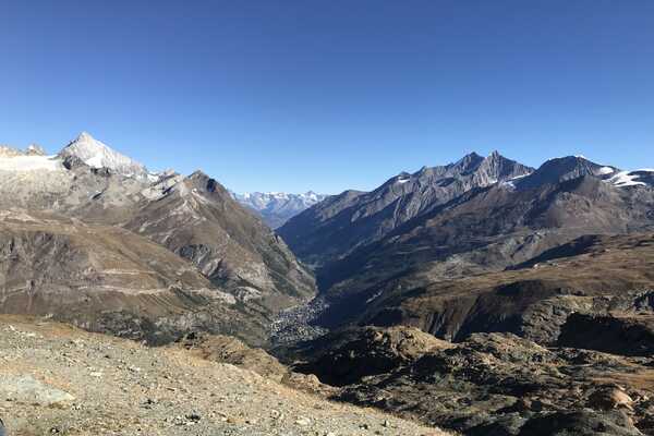
The Tour of the Monte Rosa is one of the most iconic multi-day routes in the Pennine Alps. Starting and finishing in Zermatt, it circumnavigates ten 4,000-meter summits in the Monte Rosa mountain range. As you hike, enjoy breathtaking views of the Matterhorn, Dent Blanche, Zinalrothorn, Weisshorn, Gran Paradiso, and Mont Blanc. Our guided trek follows the traditional route anticlockwise through two alpine regions in Switzerland and Italy.
This challenging trek covers approximately 140 km with around 7,000 meters of elevation gain over 9 days. A free day is included in the charming Italian village of Macugnaga, giving you a chance to rest, reflect, and recharge for the rest of the journey ahead.
Trek in Brief
- Duration11 nights
- Suitability & Grading GRADE 3 - DIFFICULT View Trek Grading
- Accommodation8 x 3* Hotels, 3 x Mountain Refuges
- Meals2 x breakfast in Zermatt, 9 x half board (evening meal and breakfast) whilst on the tour
- Group sizeMaximum 10
- Bag TransferIncluded
- Single RoomsAvailable 8 nights
- Dates 2026No Availability
- Dates 2027Spaces Available
Trek Itinerary
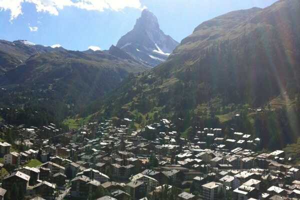
Day 1: ARRIVAL IN ZERMATT:
Arrival in Zermatt
Accommodation:
Hotel, private rooms, breakfast
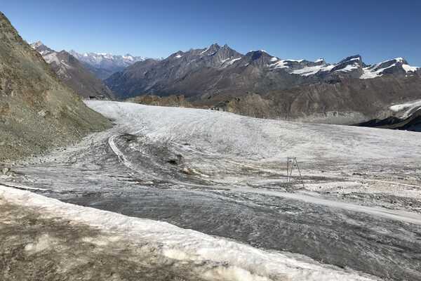
Day 2 ZERMATT TO THEODULHÜTTE:
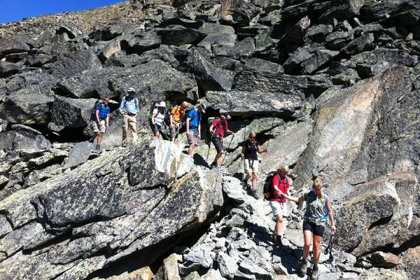
We commence our Tour du Monte Rosa from Zermatt, ascending through larch forests and passing through the hamlets of Blatten & Furi, which provide the opportunity to stop for refreshments and enjoy the surroundings. From here you will head out of the trees and meadows on to rocky and barren terrain leading to Trockenersteg and the cable car station. A final ascent via the Theodulpass glacier to the col at 3301m and the refuge which sits on the ridge with fabulous views including many of the Swiss 4000’s.
Daily stats:
Distance: 11km Height gain: +1700m Descent: -0m
Accommodation:
Refuge, dormitory, evening meal & breakfast
Day 3 THEODULHÜTTE TO REFUGIO FERRERO, RESY:
Our day starts with a descent through the ski area of Cervinia, followed by a hight traverse passing through the Colle Superiore della Cime Blanche at 2882m. From here we will leave the ski area and descent into a more remote environment, passing Gran Lago and into the valley of Alpe Mase, fabulous views of the Briethorn, Castor and Pollux. Our final ascent takes us to the hillside hamlet of Resy and to the Refugio Ferrero 2017m.
Daily stats:
Distance: 15km | Height gain: +100m | Descent: -700m
Accommodation:
Refuge, dormitory, evening meal & breakfast
Day 4 REFUGIO FERRERO TO STAFAL:
This is a relatively short day so no need for an early start, treat this as a rest as there are harder days to come! From the refuge we ascend up towards the ski lift and take the traversing path away from the Bettaforca to the alternative and more remote route via the Passo de Rothorn 2689m. From the col descend steeply at times down into the ski area of Stafal and Gressoney. Once in the ski area we descend via the chapel through the forest to the village of Stafal 1823m.
Daily stats:
Distance: 11km | Height gain: +628m | Descent: -877m
Accommodation:
Hotel, private rooms, evening meal & breakfast
Day 5 STAFAL TO ALAGNA:
Leaving Stafal make the steep ascent up the gully to high plateau within the ski area. Although the path follows the line of the cable car it is out of view and the ascent feels remote and tranquil. Once at the plateau enjoy a refuge stop at one of the many refuges before heading up through the ski area to the wild and wonderful Col d’Olen 2881m. Descend steeply at time towards the Alagna ski area, cut leftwards to get away from the ski resort by taking the route via Devils Rock to Passo Foric descending finally through the Valle d’Otro to the village of Alagana 1180m.
Daily stats:
Distance: 14km | Height gain: +1058m | Descent: - 1700m
Accommodation:
Hotel, private rooms, evening meal & breakfast
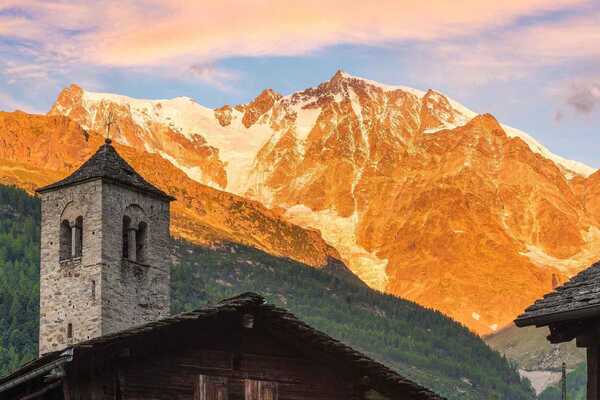
Day 6 ALAGNA TO MACUGNAGA:
A big and beautiful day ahead so we make an early start. Initially easy taking the route along the valley before our ascent to Refugio Pastore, which is nestled within a beautiful alpage. Rested and refreshed we make our way to the impressive route to Colle del Turlo 2738m. Our descent takes us on the paved trail into the remote & beautiful Valle Quarazza and finally on to Macugnaga at 1317m.
Daily stats:
Distance: 20km | Height gain: +1649m | Descent: - 1512m
Accommodation:
Hotel, private rooms, evening meal & breakfast
DAY 7 REST DAY
The full trek offers a rest day in Macugnaga giving you the opportunity to reflect on the first half of the trek and relax and enjoy this beautiful Italian alpine village.
Accommodation:
Hotel, private rooms, evening meal & breakfast
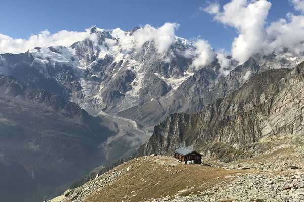
Day 8 MACUGNAGA TO SAAS FEE:
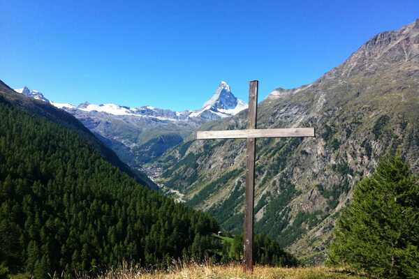
A beautiful early morning ascent through larch woodland brings us into the Macugnaga ski area, we ascend to the wonderful Monte Moro (2984m) with fabulous views of the Monte Rosa as you go. We take a detour to the iconic golden Madonna before making our descent into Switzerland and to where the road joins the trail at Mattmark (2200m). From here we will take the bus to Saas Fee at 1803m.
Daily stats:
Distance: 20km | Height gain: +1797m | Descent: -1341m
Accommodation:
Hotel, private rooms, evening meal & breakfast
Day 9 SAAS FEE TO GRACHEN:
A beautiful day awaits on the lofty traverse high above the Saas valley, making our assent from Saas Fee to the high point at Lammugrabe (2329m). The route takes us through steep boulder terrain and traverses exposed steep slopes with fabulous views as far as the Bernese Oberland. The route finally changes direction and heads right above the Matterhorn valley to the village of Grachen (1619m).
Daily stats:
Distance: 16km | Height gain: +700m | Descent: -900m
Accommodation:
Hotel, private rooms, evening meal & breakfast
Day 10 GRACHEN TO EUROPAHÜTTE:
Due to the permanent closure of day one of the Europaweg the route now avoids this section. Departing Grachen traverse along the Wanderweg to Gasenreid before descending to the Matterhorn valley. The route continues on the floor of the valley to Randa, from here we make our steep ascent to the Europahutte.
Daily stats:
Distance: 14km | Height gain: +1000m | Descent: -100m
Accommodation:
Hotel, private rooms, evening meal & breakfast
Day 11 EUROPAHÜTTE TO ZERMATT:
Departing from the refuge, we descend and take the impressive Charles Kuonen suspension bridge for a fitting final day. This section of the Europaweg is stunning as the trail traverses its way on exposed and breathtaking terrain. Beyond the exposed sections you reach Ottovan (2187m), where we can rest and reflect for a moment before continuing on the final section with incredible views of the Matterhorn that takes us on the high route into Zermatt (2215m).
Daily stats:
Distance: 21.5km | Height gain: +1175m | Descent: -850m
Accommodation:
Hotel, private rooms & breakfast
Day 12: DEPARTURE
Breakfast is included however on the departure day you are free to leave at any time you wish.
Option to add on additional days in Zermatt at the beginning or the end, please ask for further details.
Is this trek for you?
Find out with our quick fitness quiz ...
Trek Packages
Select which year do you want to travel in
£2995
Per person
£1975
Per person