Walkers Haute Route Interactive Map & Route Variations
Walker's Haute Route Map - Full Route
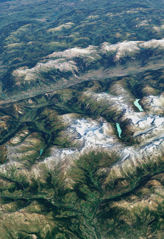
With a distance of 180km the Walker's Haute Route is a 'must do' long distance trek. It is rigorous to say the least and is reserved for the fittest of mountain walkers as the daily height gain can be substantial with the overall accumulation of 12,000m. This trektakes you over 11 mountain cols and through 2 alpine regions within France and Switzerland from Chamonix to Zermatt. When undertaken self-guided, a good deal of mountain experience is advisable.
Click the route sections on the map for more info
Plan your trek
Full Guided Trek
2027 season
Walker's Haute Route Map - Westerly Route
This Walker's Haute Route westerly trek takes you from the famous alpine town of Chamonix in the French alps to the beautiful Valaisian village of Les Hauderes and La Sage in the Evolene valley. This westerly section takes you over 115km of stunning high mountain terrain and through idyllic alpine pastures. This trek is ideal for those who haven't the time to complete the full route yet want a real flavour of this classic trek.
Plan your trek
Westerly Guided Trek
2027 season
Walkers' Haute Route Map - Easterly Route
Trek from La Sage in the beautiful Evolene valley to the famous town of Zermatt on this 80km easterly section of the classic Walkers Haute Route. The Walkers Haute Route easterly sef guided trek takes you over high mountain cols and descends into the traditional Valasian valleys of Zinal, Gruben and the Matterhorn. This trek is ideal for those wanting to trek independently & experience the route in a shorter space of time.
Plan your trek
Easterly Guided Trek
2027 season
Key facts
- Distance
- 180 km / 112 miles
- Height gain
- 12,000m / 39,400ft elevation
- Grade
- Grade 4
- Top 10
- Top 10 ‘must do’ trek
- Regions
- Mont Blanc to the Matterhorn
Trek Information
Map & Route FAQs
What is the Walker’s Haute Route (WHR)?
The Walker’s Haute Route is an iconic long-distance trekking route in the Alps, connecting Chamonix in France to Zermatt in Switzerland. It features stunning alpine scenery, including glaciers, high mountain passes, and picturesque villages.
How difficult is the Tour du Mont Blanc?
The Walker’s Haute Route is undoubtedly a breathtaking trek, but it is also very demanding. Each day presents challenging terrain, requiring stamina and endurance. This route takes you through rugged, mountainous landscapes, with significant ascents and descents.
We grade our treks on a scale of 1 to 4, with 1 being relatively easy and 4 being the most challenging. Each trek is assigned a grade based on the difficulty of the terrain and the number of consecutive trekking days required.
GRADE 4 – Toughest
The Walker’s Haute Route is one of the most physically demanding treks we offer, requiring a high level of fitness and prior mountain trekking experience. This trek involves continuous and significant elevation changes, with daily ascents and descents exceeding ±1,500 meters (5,000 feet) without rest days.
On some sections, you will reach altitudes of up to 3,000 meters (9,842 feet), navigating remote, exposed and rugged terrain. Expect steep, rocky ascents and descents. Proper preparation is essential for tackling the challenges of this exceptional high-alpine trek.
How long does it take to complete the Walker’s Haute Route?
The WHR Full Guided Trek takes 10 days with 12 nights accommodation.
Shorter treks - A ‘Best of’ trek, Easterly or Westerly trek routes are available and take between 5-7 days.
When is the best time to hike the WHR?
The trek is best done from mid-June to mid-September, when the mountain passes are snow-free and accommodations are open. Early-season treks (June) may have some lingering snow, while late-season treks (September) offer quieter trails and cooler weather.
How does a self-guided trek work?
We book your accommodation and meals, give you unlimited expert advice and supply you with all the necessary information before you depart. We supply you with a detailed itinerary, daily route cards, emergency and language cards, IGN 1:25,000 or 1:50,000 Swiss Topo maps, safety and information cards giving you further essential information on your chosen trek.
We meet you before you start your trek to give you any last minute advice and route information that will be essential to the smooth running of the trek.
What support is available on a self-guided trek?
Mont Blanc Treks provides 24/7 emergency support, detailed route guidance, and logistical assistance to ensure a smooth journey.
Trek Packages
Which year do you want to travel in:
£3395
Per person
£2445
Per person
£2195
Per person
£1945
Per person
£1845
Per person
£2245
Per person
£1945
Per person
Departure dates 2027
Full Guided Trek
- 26th July - 6th AugSpaces Available
- 14th-26th AugSpaces Available
- 29th Aug - 10th SeptFully Booked
Westerly Guided Trek
- No Availability
Easterly Guided Trek
- No Availability
Full Self-Guided Trek
- Spaces Available
Best Of Self-Guided Trek
- Spaces Available
Westerly Self-Guided Trek
- Spaces Available
Easterly Self-Guided Trek
- Spaces Available
Refuges Self-Guided Trek
- Spaces Available
Best of Refuges Self-Guided
- Spaces Available
Departure dates 2028
Full Guided Trek
- 25th July - 6th AugSpaces Available
- 15th-27th AugSpaces Available
- 29th Aug - 10th SeptSpaces Available
Westerly Guided Trek
- No Availability
Easterly Guided Trek
- No Availability
Full Self-Guided Trek
- Spaces Available
Best Of Self-Guided Trek
- Spaces Available
Westerly Self-Guided Trek
- Spaces Available
Easterly Self-Guided Trek
- Spaces Available
Refuges Self-Guided Trek
- Spaces Available
Best of Refuges Self-Guided
- Spaces Available